


Voting District 0009, Pecos County, Texas
About
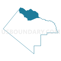
Outline

Summary
| Unique Area Identifier | 676404 |
| Name | Voting District 0009 |
| County | Pecos County |
| State | Texas |
| Area (square miles) | 535.89 |
| Land Area (square miles) | 535.00 |
| Water Area (square miles) | 0.89 |
| % of Land Area | 99.83 |
| % of Water Area | 0.17 |
| Latitude of the Internal Point | 31.18442540 |
| Longtitude of the Internal Point | -102.72459870 |
Maps


Graphs
Select a template below for downloading or customizing gragh for Voting District 0009, Pecos County, Texas


Neighbors
Neighoring Voting District (by Name) Neighboring Voting District on the Map
- Voting District 0001, Crane County, TX
- Voting District 0002, Crane County, TX
- Voting District 0003, Crockett County, TX
- Voting District 0005, Pecos County, TX
- Voting District 0006, Pecos County, TX
- Voting District 0007, Pecos County, TX
- Voting District 0011, Reeves County, TX
- Voting District 003S, Ward County, TX
Top 10 Neighboring County Subdivision (by Population) Neighboring County Subdivision on the Map
- Fort Stockton CCD, Pecos County, TX (13,124)
- Pecos CCD, Reeves County, TX (12,808)
- Monahans CCD, Ward County, TX (9,555)
- Crane South CCD, Crane County, TX (3,118)
- Imperial CCD, Pecos County, TX (761)
- Grandfalls CCD, Ward County, TX (514)
- West Crockett CCD, Crockett County, TX (115)
Top 10 Neighboring Place (by Population) Neighboring Place on the Map
Top 10 Neighboring Unified School District (by Population) Neighboring Unified School District on the Map
- Pecos-Barstow-Toyah Independent School District, TX (13,521)
- Fort Stockton Independent School District, TX (13,461)
- Crane Independent School District, TX (4,375)
- Crockett County Consolidated Common School District, TX (3,719)
- Iraan-Sheffield Independent School District, TX (1,642)
- Grandfalls-Royalty Independent School District, TX (528)
- Buena Vista Independent School District, TX (404)
Top 10 Neighboring State Legislative District Lower Chamber (by Population) Neighboring State Legislative District Lower Chamber on the Map
- State House District 82, TX (163,234)
- State House District 53, TX (145,845)
- State House District 74, TX (143,566)
Top 10 Neighboring State Legislative District Upper Chamber (by Population) Neighboring State Legislative District Upper Chamber on the Map
Top 10 Neighboring 111th Congressional District (by Population) Neighboring 111th Congressional District on the Map
Top 10 Neighboring Census Tract (by Population) Neighboring Census Tract on the Map
- Census Tract 9505, Pecos County, TX (5,616)
- Census Tract 9501, Crane County, TX (4,375)
- Census Tract 9501, Reeves County, TX (4,319)
- Census Tract 9501, Ward County, TX (4,037)
- Census Tract 9501, Crockett County, TX (3,719)
- Census Tract 9501, Pecos County, TX (2,383)